


An amber cold-health alert has been issued for the south east

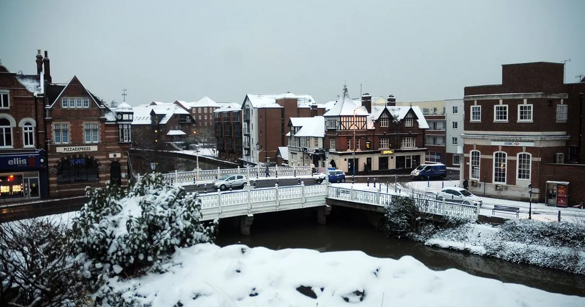
Kent is bracing for back-to-back days of snow and sleet as the New Year’s freeze continues to chill the nation, according to experts working at BBC Weather. A flurry of snow is currently set to hit the county on Tuesday and Wednesday (January 6 and 7), with sleet continuing from Thursday to Sunday (January 8 to January 11).
Since January has begun, England has endured sub-zero temperatures thanks to the arrival of Arctic air which has created a prolonged period of cold. A yellow weather warning for snow and ice has been in place over much of Kent this morning (January 2) as temperatures plummeted during the night, with many awakening to frost-covered cars and, even, the occasional snow flurry towards the west of the county.
Forecasters predict the cold snap to linger a while longer, resulting in the issuing of an amber cold-health alert from the UK Health Security Agency (UKHSA), covering all of England. This followed a previous yellow cold-health alert, with the current amber warning coming into effect from 8pm on New Year’s Eve and due to remain in place until 10am on Tuesday (January 6).
During this time, health experts have advised the cold weather is expected to have significant impacts across the health and social care services. This includes a rise in deaths, particularly among those aged 65 and over or with health conditions, while younger age groups may also be impacted.
Temperatures inside hospitals, care homes and clinics could drop below the levels recommended for assessing health risks. Additionally, there will be added difficulties in keeping indoor temperatures at the recommended 18C, creating more risk for vulnerable people.
Emergency services and other industries, such as transport and energy, may see staffing issues due to external issues such as travel disruption. Dr Agostinho Sousa, head of extreme events and health protection at UKHSA, said: “As the colder weather sets in it is vital to check in on friends, family and neighbours that are most vulnerable.
“The forecast temperatures can have a serious impact on the health of some people, leading to increased risk of heart attacks, strokes and chest infections, particularly for individuals over the age of 65 and those with pre-existing health conditions.” Temperatures across Kent are expected to sit around freezing over the coming days, hitting as low as -4C at times.
It is next week that we could see snow flurries arrive over the county, according to the latest predictions from BBC Weather. The latest forecasts detail the arrival of snow flurries over the west and north of the county from Tuesday (January 6).
From this date, areas including Tonbridge, Sevenoaks, Medway, Dartford and Tunbridge Wells are expected to see light snowfall. Towards the end of the week and over both days of the weekend however, this will turn to sleet for most of Kent as temperatures linger in the low single digits during the day, and creep below 0C overnight.
Chief forecaster, Neil Armstrong, said: “With Arctic air now covering most of the UK very cold weather will continue through the weekend, with minus double figures overnight in places and daytime temperatures struggling to rise above 0°C for some. It looks like this cold spell could last well into next week and wintry hazards will continue with more weather warnings likely. It is therefore important people keep up to date with the latest forecast and warnings and plan ahead.”
While confidence in long range forecasts is lower at this time, an indication on when the cold snap could end has been given. The Met Office long range forecast for the period between Thursday, January 6 and Thursday, January 15 describes that the outlook from next weekend (January 10 and 11) is more uncertain, though it is most likely that conditions will be less cold than recently, but there still remains potential for further spells of snow, especially in northern and central areas.
Here in the south, some milder interludes are possible, with the chance of heavier rain and stronger winds at times. Once again, the forecast for the remainder of January beyond this period is very uncertain, with no strong indication for any particular weather pattern to dominate, though the chance of snow and ice is lower than the start of the month, particularly towards the south.
Get more news from KentLive straight to your inbox for free HERE


